Name the motion
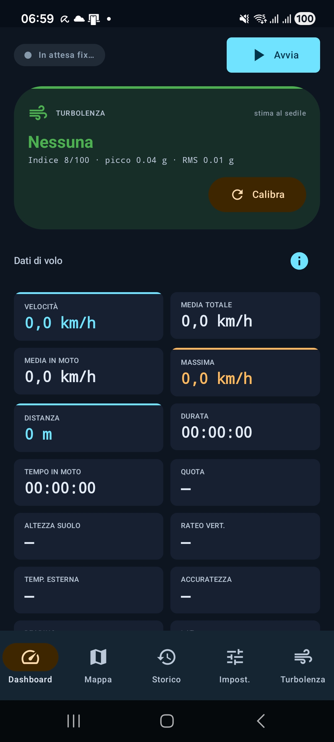
A seat turbulence index, peak g and RMS values help separate a sensation from a measurable event.
Flight data for calmer passengers
Track your flight offline, see real GPS data, and compare turbulence forecasts with what your phone actually measures in the cabin.
For nervous flyers, clear numbers can make the unknown smaller: speed, altitude, route, ETA and turbulence become understandable instead of invisible.
For fear of flying
Turbulence is often frightening because passengers cannot see what is happening. SteadySky turns the flight into readable context: where you are, how fast you are moving, how high you are, what the route looks like, and how cabin movement compares with the forecast.
A seat turbulence index, peak g and RMS values help separate a sensation from a measurable event.
Maps, ETA and arrival distance replace “how much longer?” with a visible path forward.
The core tracker works in airplane mode with local GPS, so the calm data is available when the cabin is offline.
Complete Android launch scope
SteadySky combines offline tracking, route intelligence and turbulence awareness in one Android app.
Track speed, altitude, heading, distance, climb and descent with the phone GNSS sensor, even in airplane mode.
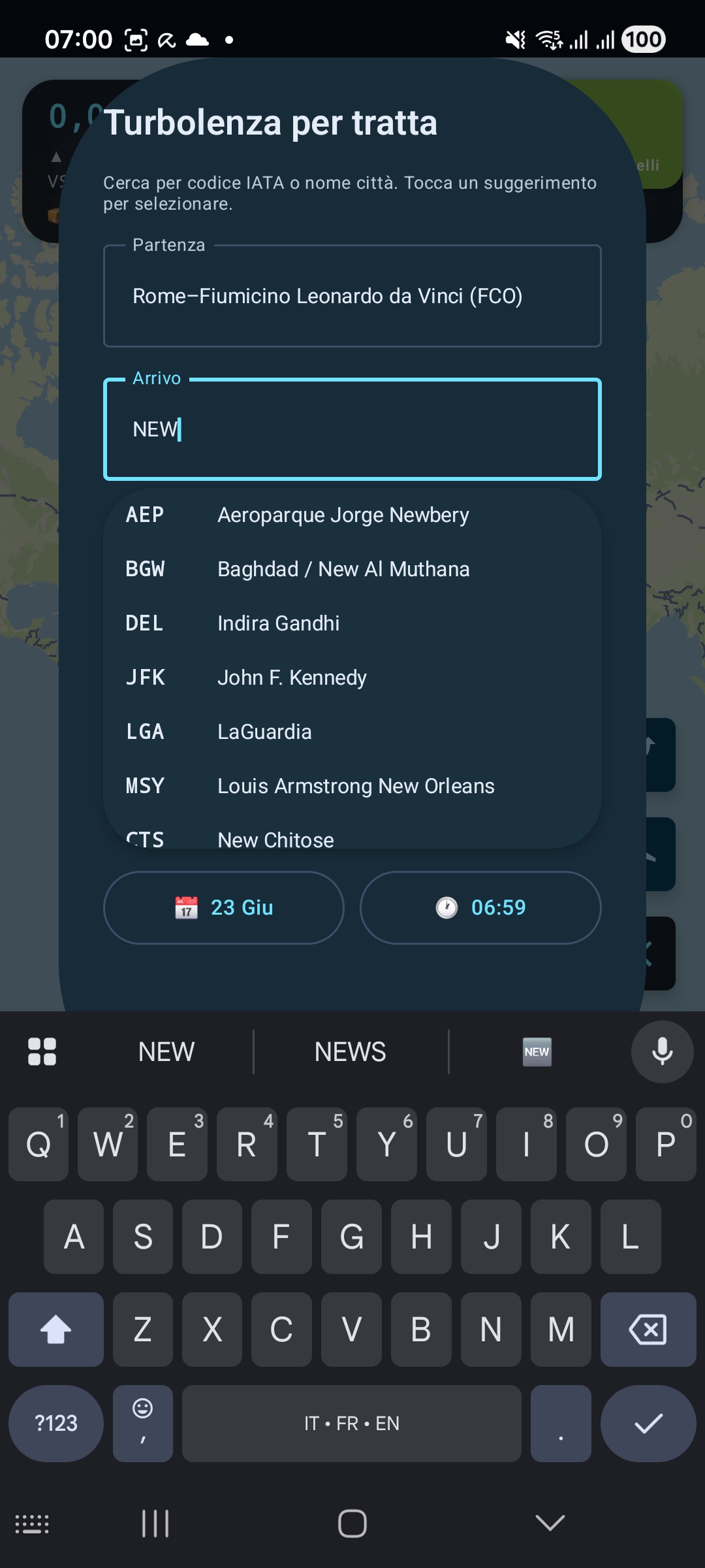
Check route turbulence from upper-air weather, Open-Meteo, OpenSky anonymous tracks, NOAA AWC PIREP and SIGMET data.
Use the accelerometer for a seat-level turbulence estimate with index, peak g and RMS values.
A world base map is included. MapLibre, PMTiles/MBTiles support and radar fallback keep the route visible.
Search more than 4,000 airports by city, name or IATA code, then follow ETA and arrival distance.
View AGL on approach, outside air temperature estimate, satellites, point quality and every key flight value.
Save sessions locally, review the track, and export flight data as GPX, CSV or JSON.
No account, no analytics, no developer server. GPS sessions stay on the device.
What it measures
The app turns raw sensors and public aviation weather into readable values that help you understand the flight from your seat.
Actual app screens

Android launch plan
The Android app is planned with a strong free experience and optional Pro tools for frequent flyers.
Privacy and data sources
SteadySky has no developer server for your flight sessions. The offline tracker processes GPS locally; the optional turbulence section uses public sources only when you request online data.
Read the privacy policyGood to know
No. SteadySky is informational and recreational. It must not be used for aeronautical navigation, flight safety or operational decisions.
Yes, if the phone keeps system location enabled. GPS fix can take a few minutes in the cabin and usually works best near a window.
Yes. Forecast, PIREP, SIGMET and weather data come from public online services. The core GPS tracker remains offline.
English, Italian, French, German, Spanish, Russian and Chinese are planned for the Android interface.